Let’s talk about the Laurel Brooke Dam. What? Yes, that’s correct. Laurel Brooke has a dam. It’s difficult to notice because it’s hidden behind a few of homes off River Laurel Way in the wooded section of “conservation land” that surrouds the neighborhood. It’s breeched, covered over with dirt, and has foliage growing on top of it.
Its purpose was to retain water from the creek flowing through the neighborhood’s center, thus forming a large reservoir extending from Arnold Mill Road at the neighborhood’s entrance down to 278 River Laurel Way, a distance of nearly 1900 feet, or approximately 5.3 football fields in length! That’s a lot of water!
The reservoir is referred to as “Detention Pond A” on the plat documents for the neighborhood. It was most likely used for irrigation of farm properties along the creek, drinking water for livestock, and maybe even in the homes for drinking/washing.
Here’s a photo from Google Earth of where the dam is located and the approximate length of it. In its current form it’s about 230 feet in length…almost as long as a Boeing 747 jet! The image is not a good representation of what it looks like though because Google Earth just superimposes satellite imagery over the contours of the land. I believe the dam is actually buried under a considerable amount of dirt, and vegetation has grown over the top of it. The actual stone structure is probably not visible.

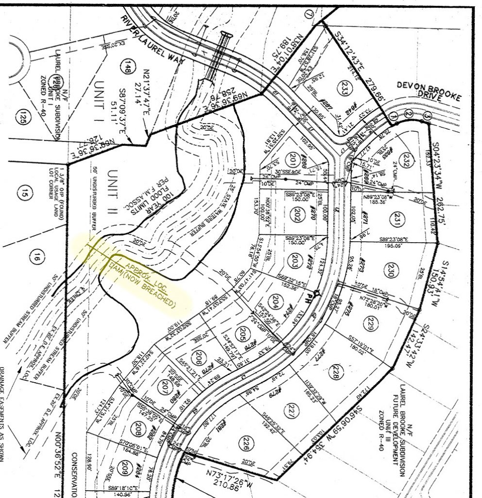
Sharp Residential Builders/Developers even had it diagramed on their plat documents when the neighborhood was being developed and built. It resides in the Unit 2 section of the neighborhood. I’ve highlighted the dam in yellow and rotated this map so north points up. You can see on the diagram that River Laurel Way was built right over what used to be the reservoir, and there was a culvert containing 3 cement pipes run under the road to allow the creek to still flow through.
Based on historic aerial photography, it looks like the dam was built sometime between March 1956 and Feburary 1958. I’m still researching who owned the land around that time to get a list of names that may have built it. The roads in the area were New Woodstock Road (aka Arnold Mill Road), Grimes Road, and a very long Rucker Lane.
Below are some aerial photos from the years I have that show what it looked like over time. I’m going to omit images I have prior to 1956 as there doesn’t appear to be any reservoir off the creek before that timeframe. Also, for the images below, you can click on each of them to get a full-sized version of the photo.
In this 1956 photo you can see that there was a very small retention pond even before the dam was built (most likely naturally occurring).
Also the crescent-shaped farm to the south of the pond appears to be well-maintained. Land is cleared out for farming there’s a handful of identifieable buildings on the property. This farm was in the area that is now the cul-de-sac of River Laurel Way and Fairview Lane
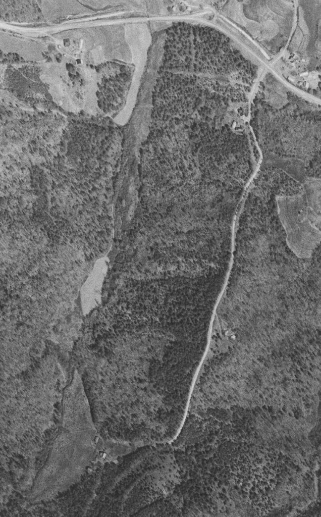
One built, you can see in this 1958 photo that it flooded the flat valley surrounding the creek and formed a large, dagger-shaped body of water. The top point of the reservoir met up with New Woodstock Road (now known as Arnold Mill Road). You can see Grimes Road / Rucker Lane to the east of the reservoir.
Immediately surrounding the creek and reservoir were at least 7 properties with cleared land most likely used for farming/livestock. My theory is that the “crescent-shaped” farm south of the reservoir was the one responsible for its construction. It’s entirely possible that the other properties also used it, and may have contributed with funding and manual labor to build it.
Also it appeasr the property mid-way down Rucker Lane on the east side of the road has ben abandoned and that house will be removed in the next photo.
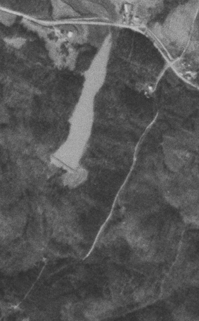
This image is from 1960 and shows more detail about the dam, roads leading up to it, and even some cleared land around the SE corner of it. There’s very clear pathways to the dam area from Rucker Lane. One of them appears to lead to a small area at the shoreline in front of the dam. Was that a beach?
What’s interesting to me about the previous 1958 and this 1960 photo is that the crescent farm to the south of the reservoir appears to be no longer maintained at this point. The cleared land seems to have tree growth. Did they build the dam, and then give up and sell their farm? Was the reservoir no longer needed?

This photo is from 1966, and clearly shows that both the crescent farm to the south, and the previously cleared land around the dam are no longer being maintained. Tree growth is occurring. This photo is clear enough that you can even start to see a shadow being cast by the dam on the water.
Also it appears the house and other buildings from both the crescent farm and the property on the east side of Rucker Lane are gone/demolished.
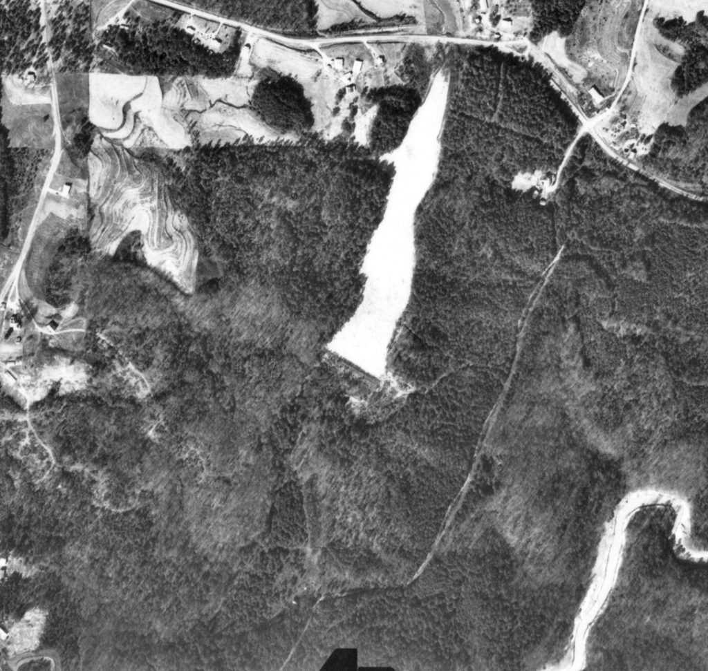
This amazingly clear photo from 1968 shows a LOT of detail about the dam and reservoir. For starters, the dam has been breached on the west side of it, and the reservoir is drying up. There’s still a pool of water in front of the dam, but that won’t last long. You can see vegetation already growing at the top section of the reservoir.
The level of the land below the dam is so low that a massive shadow showing small tree growth on the top of the dam is clearly visible. Rucker Lane looks very unmaintained beyond the first house. There’s only one property on it to the south at this point in time.
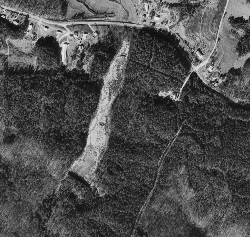
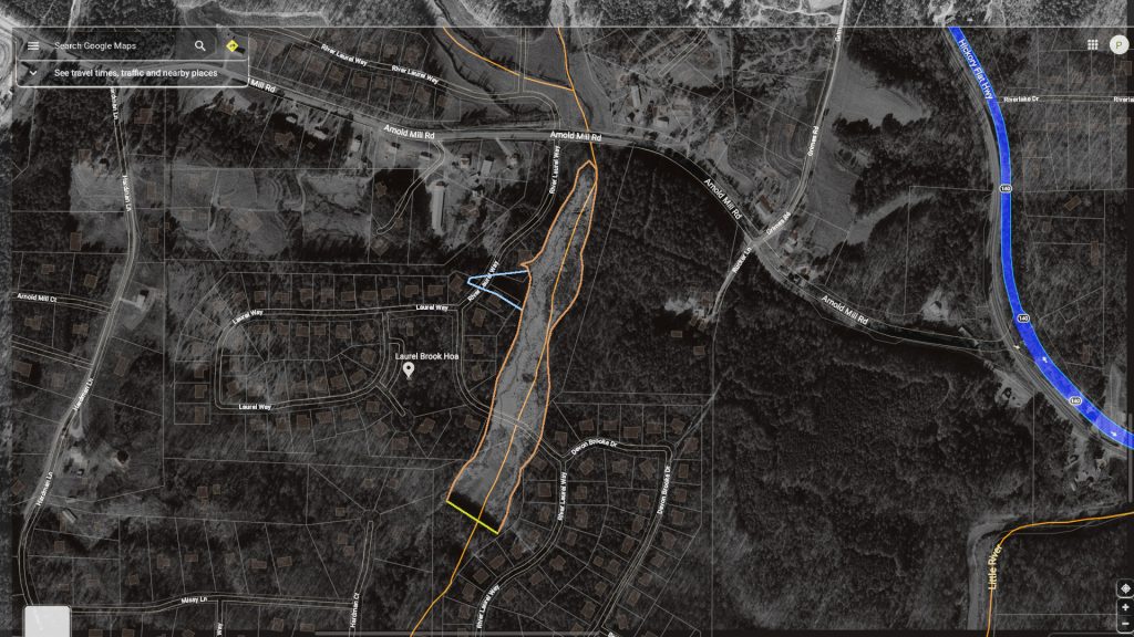
Since 1968 will be the last time good imagery is available of the shape of the original reservoir, I decided to overlay an image of Laurel Brooke streets and houses on top of it so you can get a better idea as to where things line up back then with what exists now.
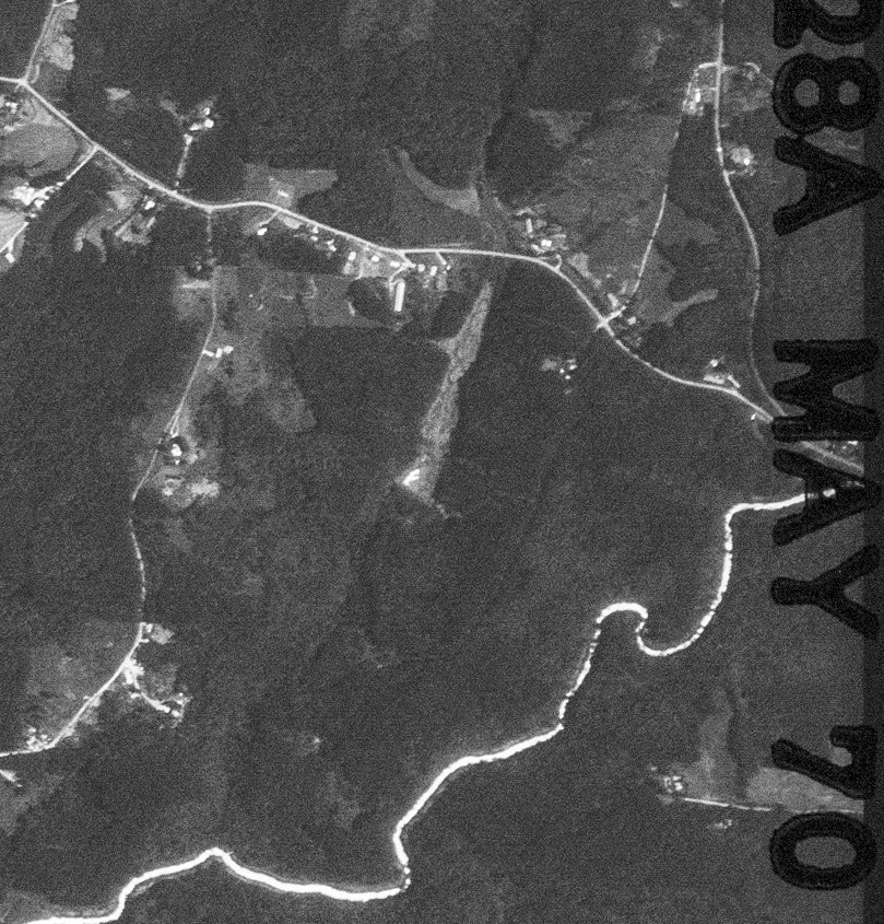
The next image I have is from May 1970, and unfortunately isn’t as detailed. I snagged more of an area so you can see the Little River, Hardman Lane, and even Mountain Road at the top left.
What we can determine on this image is that the reservoir is definitely drying up and being reclaimed by nature. Water seems to show as very reflective on this image, so the bottom left corner of the reservoir is the only bit of water left.
1974 imagery doesn’t show too much change. The small pocket of water in front of the dam is gone, and now it appears it’s a dry bed being reclaimed by nature. The creek is finding it’s way again and carving out a pathway around the dam.
The long-gone crescent farm is barely visible due to tree growth. You can still make out the edge lines of it and the creek was the western border.
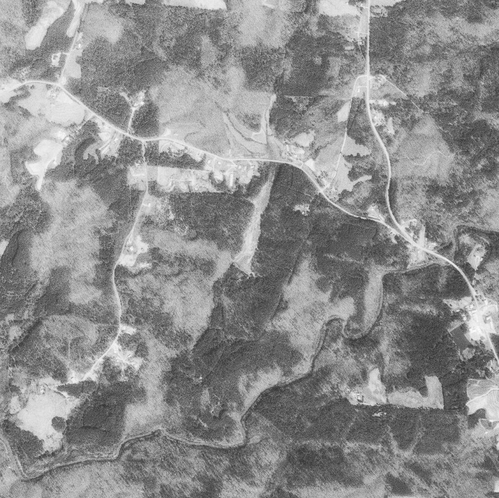
By 1978 the northern section of the reservoir is not visible anymore due to tree growth. The rest of the area is also becoming more covered. Its shape is narrowing and the dam is becoming difficult to identify. This is the last image I was able to obtain until the 90’s
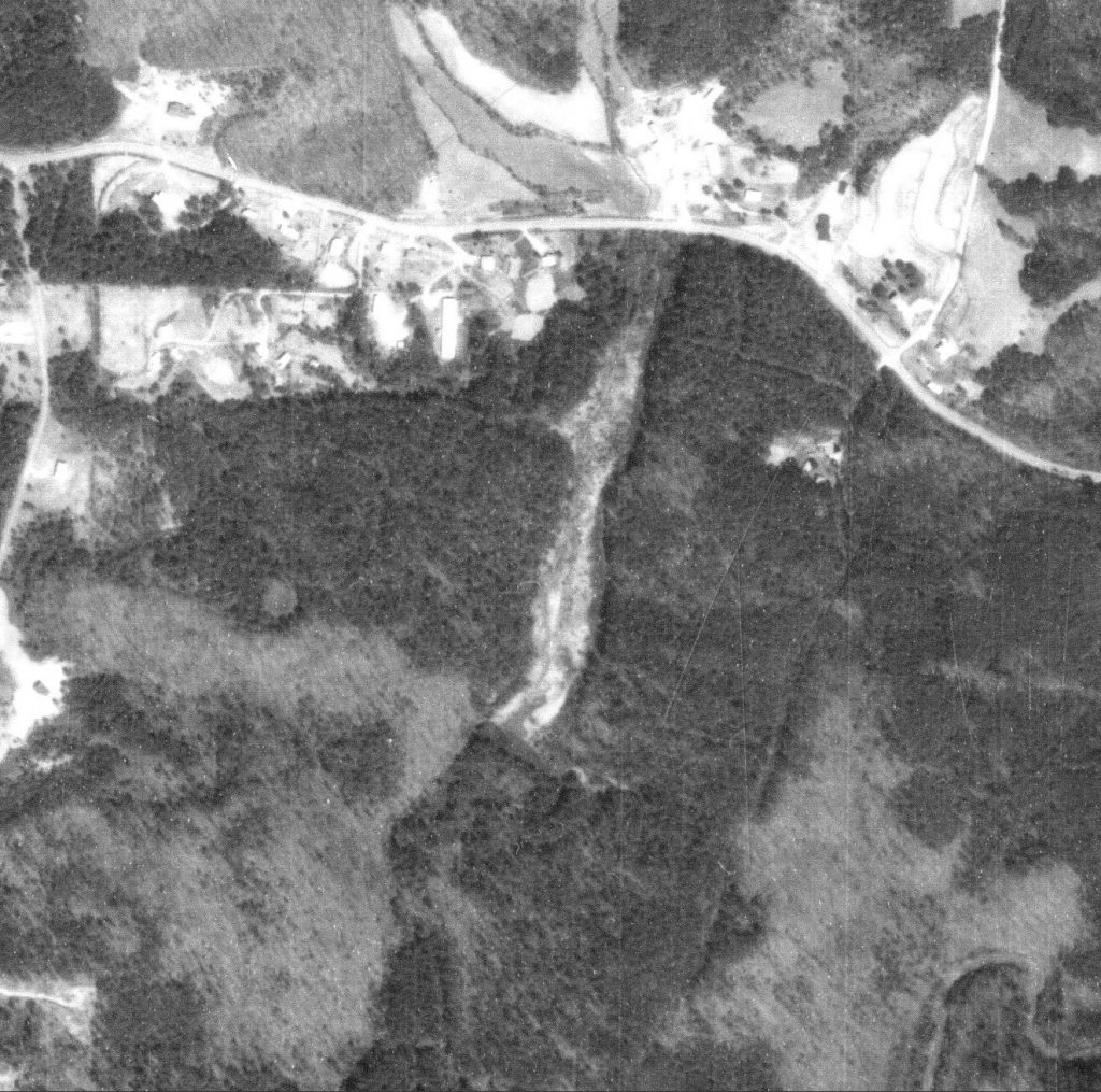
I have two images from January 1993. The first one here clearly shows that 15 years of time has allowed the woods to completely reclaim the reservoir land. In this image you can’t barely even make out the edges of where it used to be.
Also many of the properties to the north and west of the former reservoir are no longer maintaining their land for farming/livestock.
Finally, you can see the Hardman Place neighborhood was built sometime around 1986, and two of the homes off Hardman Court were built on the other side of the creek. So it flows right past these homes and under their private road. The former dam resides directly west of 403 Hardman Court.
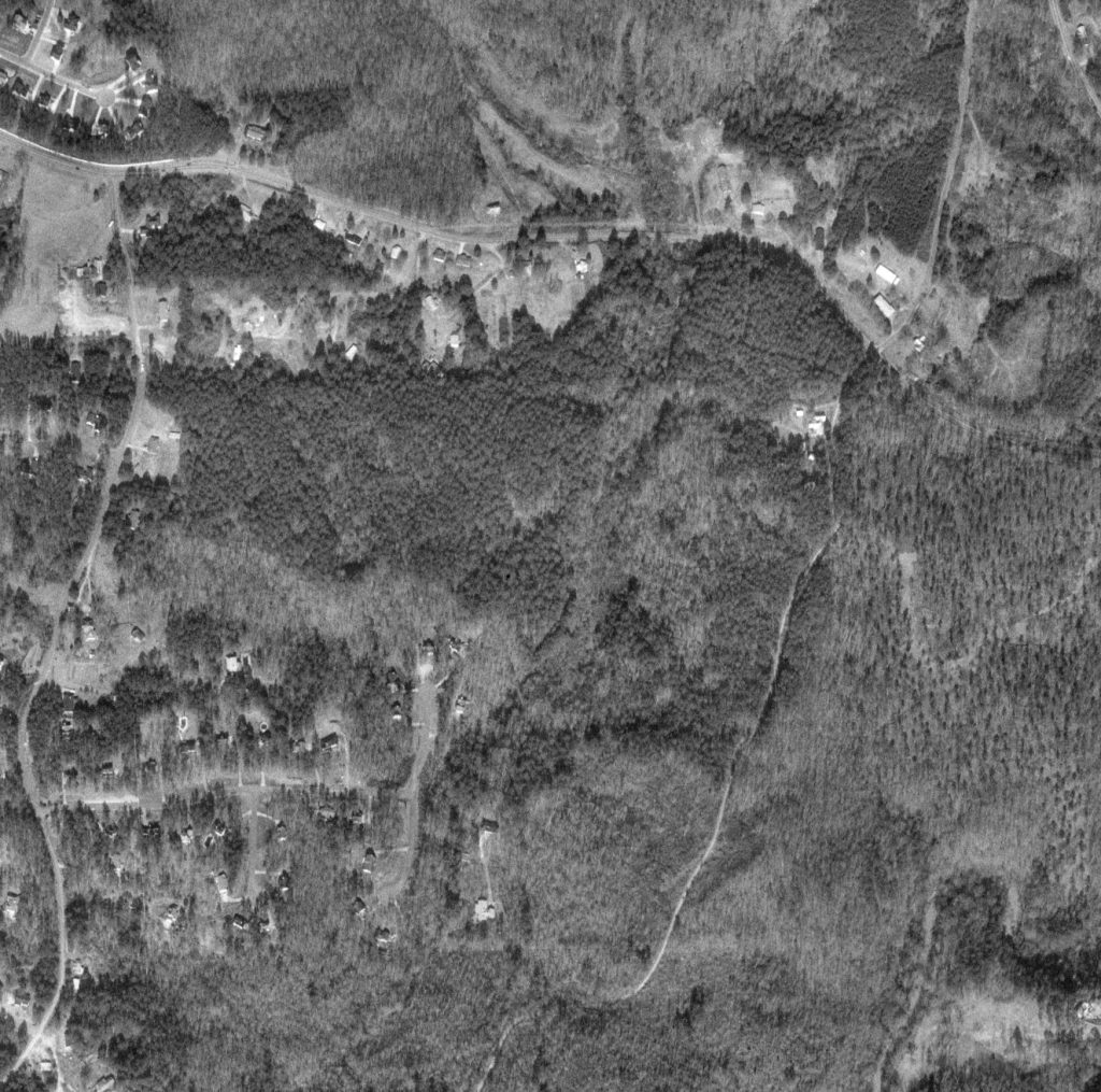
The second image from January 1993 is lower quality, but the contrast is higher on it which might make it possible to see the former outline of the reservoir easier.
This image is zoomed out a bit more so the house at the very end of Rucker Lane is visible. This is not the same house that was there in the 1950-1970’s images. The house in this image was built in 1981 and is still there today. It’s now at 150 Fairview Lane which is a private road embedded in the middle of Laurel Brooke neighborhood.
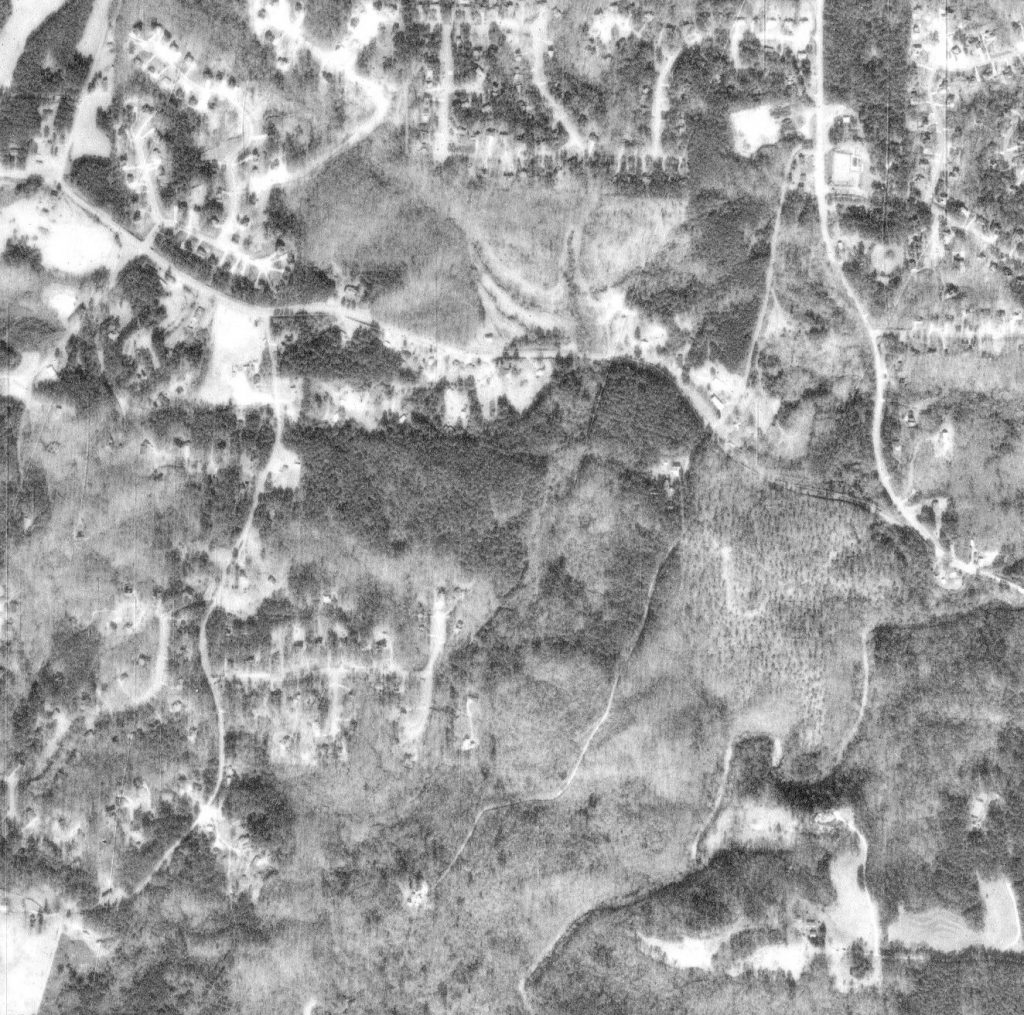
This picture is from February 1999. Color information was present on this image, but it was off. So, I had to adjust the hue so it more closely matched actual colors.
Similar to the 1993 images, there’s almost no way to tell where the reservoir was in this image, and unless you know what to look for, the dam isn’t visible either.
Laurel Brooke land remains undeveloped, and properties that once had farms or fields are no longer maintained, allowing trees and vegetation to take over.
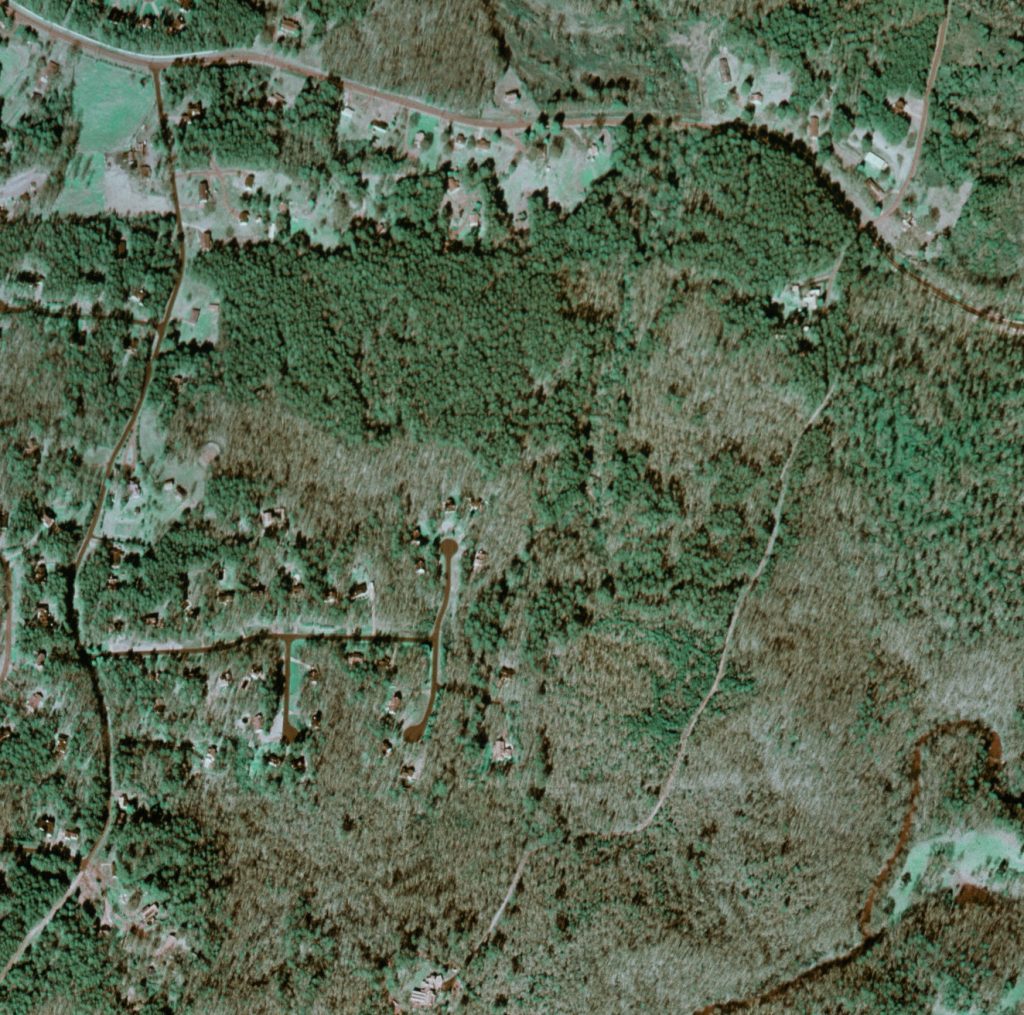
April 2002 brought us the highest resolution color imagery yet. Lots of changes happened on this land. The construction of Unit 1 and 2 of Laurel Brooke subdivision meant a lot of land was cleared out and altered for roadways, drain sewers, and other utilities.
The dam is actually somewhat visible in this image due to a dark shadow that appears on the left side of it, and more green and denser tree coverage to the north of it.
The creek pathway is clearly visible, but the outline of the former reservoir is not. River Laurel Way road cuts right over the former middle section of the reservoir, and culverts were built into the raised roadway to allow the creek to still pass through.
Rucker Lane no longer travels through this area. It was ended at the NE corner of Laurel Brooke property line, and is generally considered a private road for the house that still exists on it.
The other house that used to be on Rucker Lane (not visible in this image) to the south is now embedded in the middle of Laurel Brooke, and a new private road called Fairview Lane was created for access to that home.
The former crescent shaped farm property is now occupied by houses at the end of the cul-de-sac on River Laurel Way just before Fairview Lane starts.
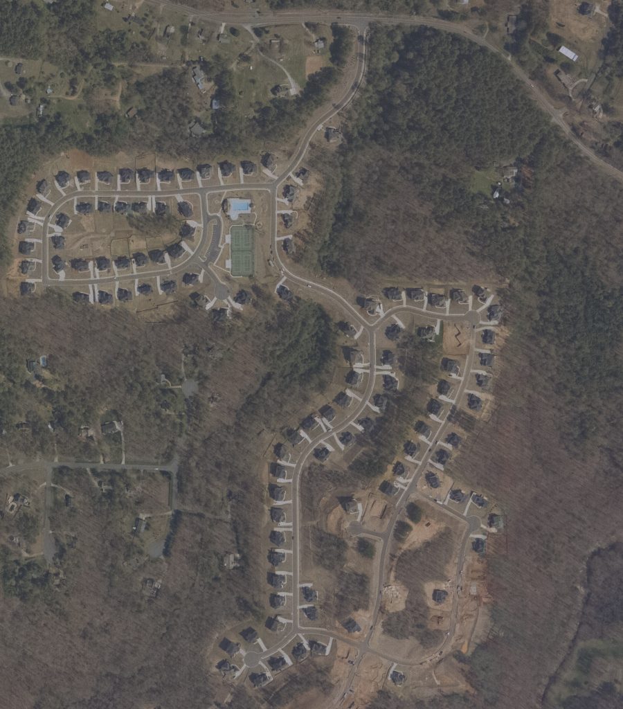
I plan to try and get some current images from ground level hopefully before Spring 2025. Laurel Brooke owns all of the surrounding land that the former dam and reservoir reside on, so anyone from the neighborhood can legally hike on that land without breaking any private property / trespassing law. Once I have some images, I’ll update this page. Thanks for reading!