Ever sit on your back porch enjoing a cold beverage and look out at your yard and wonder “what was here before this neighborhood”? I wondered enough that I started studying the land that Laurel Brooke resides on and decided to dig into the history of its ownership as far back as I could go. I still have a lot of “holes” in the timeline to research, but this is a decent approximation of who owned the land and when.
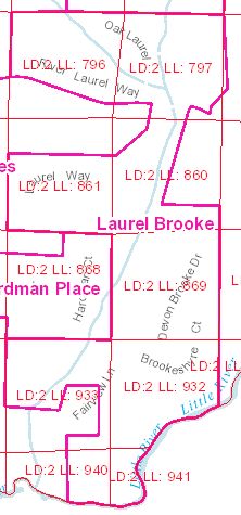
Laurel Brook resides in the Land Lots in District 2 listed below. Georgia uses a historical land surveying and distribution system known as the Land Lot System. This, system was primarily established in the early 19th century to manage and distribute land to settlers as the state expanded westward. It’s still loosely used today to describe plots of land on plat documents.
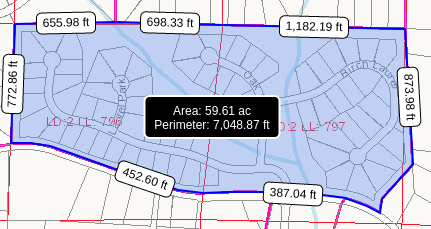
LB North – 796, 797
LB Mid-North – 861, 860
LB Mid-South 869
LB South – 933, 932
LB Little River – 940, 941
Approx 218 acres
Land Ownership Timeline:
- 1832 – Gold Land Lottery Winners
- [796] William Hanson
- [797] Eli Eberhart
- [861] James Lane
- [860] Carey Johnson
- [869] James George
- [933] Joshua J. Ellis
- [932] Samuel Field
- [940] Nathaniel Quick
- [941] Ashford Quinn
- 1832-1905 – Research needed to determine how the land lots were split up and sold to W.L. Chamlee below, and what happened with the rest of the lots not mentioned in this time frame.
- 1905
- [796, 797, 798, partial 859] – W.L. Chamlee sold land to S.B. Grimes (Deed Book PP/277). W.L. Chamlee was living at “4 Arnold Mill Road”
- 1944
- [796, 797, 798, partial 859] – S.B. Grimes sold land to J.D. Grimes (Deed Book 12/569). Approx/assumed sections shown in diagram below.
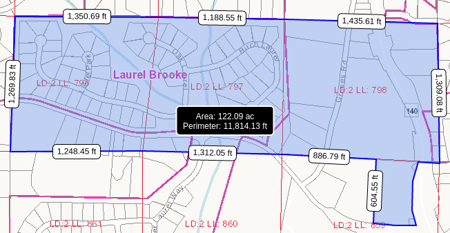
- [796, 797, 798, partial 859] – S.B. Grimes sold land to J.D. Grimes (Deed Book 12/569). Approx/assumed sections shown in diagram below.
- 1956
- [797, 860, 869] – Plat filed for 13.5 acres of land owned by Ralph & Homer Danger/Dangar. (Plat Book 1/200). Reference deed in Book 39/361 from the 1957 image shown here.
- New Woodstock Road is now known as Arnold Mill Road.
- The “Branch” listed here on this image is the small creek that runs through Laurel Brooke along River Laurel Way.
- 1957
- [797, 860, 869] – Warranty deed from Ralph Dangar and Homer H. Dangar to Eugene Patten and Robert Patten for 13.5 acres (Deed Book 39/361). See Plat 1/200.
- Need to find out how Ralph/Homer got this land before 1957. Looks like Malcolm/Eugene/Robert Patten may have been the ones to have built the dam sometime before 2-21-1958.

- 1959
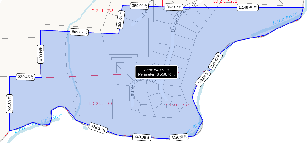
- [932, 933, 939, 940, 941] – Warranty deed from W.C. Carson to Jeff A. Hedden for 45.9 acres recorded in Deed Book 50/59. Reference Security Deed Book 35/337. Approximate diagram below.
- [860, 861, 797] – Warranty Deed from Roy Lamanac to Jeff A. Hedden for 3 tracts of land (Deed Book 51/330).
- 1) south part of [861] 27.15 acres
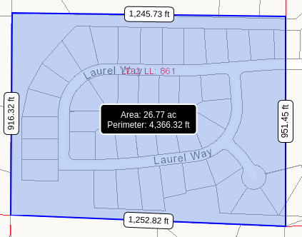
- 2) triangle of part of [860] 0.5 acres
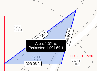
- 3) part of [797] unknown acreage.
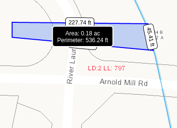
- 1) south part of [861] 27.15 acres
- [860, 861, 797] – Affidavit signed by Roy Lamanac stating he bought the above mentioned land on March 27th, 1947 from W.W. Chadwick which was recorded in Book 15/348. Affidavit recorded in Book 51/337. Pull this deed in book 15/348 and document it!
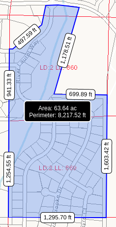
- [797, 860, 869] – Warranty Deed from Malcolm E. Patten and Robert R. Patten to Jeff A. Hedden for 65 acres. Mentions being formerly owned by Ralph Dangar, Homer H. Dangar sold to Eugene Patten and Robert Patten on February 1, 1957 and recorded in Book 39/361 and 362. Book 51/328. So apparently Malcolm E. Patten’s middle name is Eugene, so he also went by Eugene Patten, or just “Gene” as mentioned on his gravesite. Robert R. Patten’s gravesite is also local. They both have the freemason symbol on their grave markers. Approximate land shown in below image. Find out how Malcolm got this land and where it was combined with Plat 1/200.
- [932, 933, 939, 940, 941] – Warranty deed from W.C. Carson to Jeff A. Hedden for 45.9 acres recorded in Deed Book 50/59. Reference Security Deed Book 35/337. Approximate diagram below.
- 1967
- [932, 933, 940, 941] – Plat recorded for a split in land between Don Tolbert (20.62 acres) and Copeland & Marsh (25 acres). Plat book 4/54. Research the deeds that split this land, and find out why its not listed as owned by Jeff Hedden in this plat based on Deed Book 50/59. Also, that top square section of land I believe was for the dam that was created to fill the resevoir.
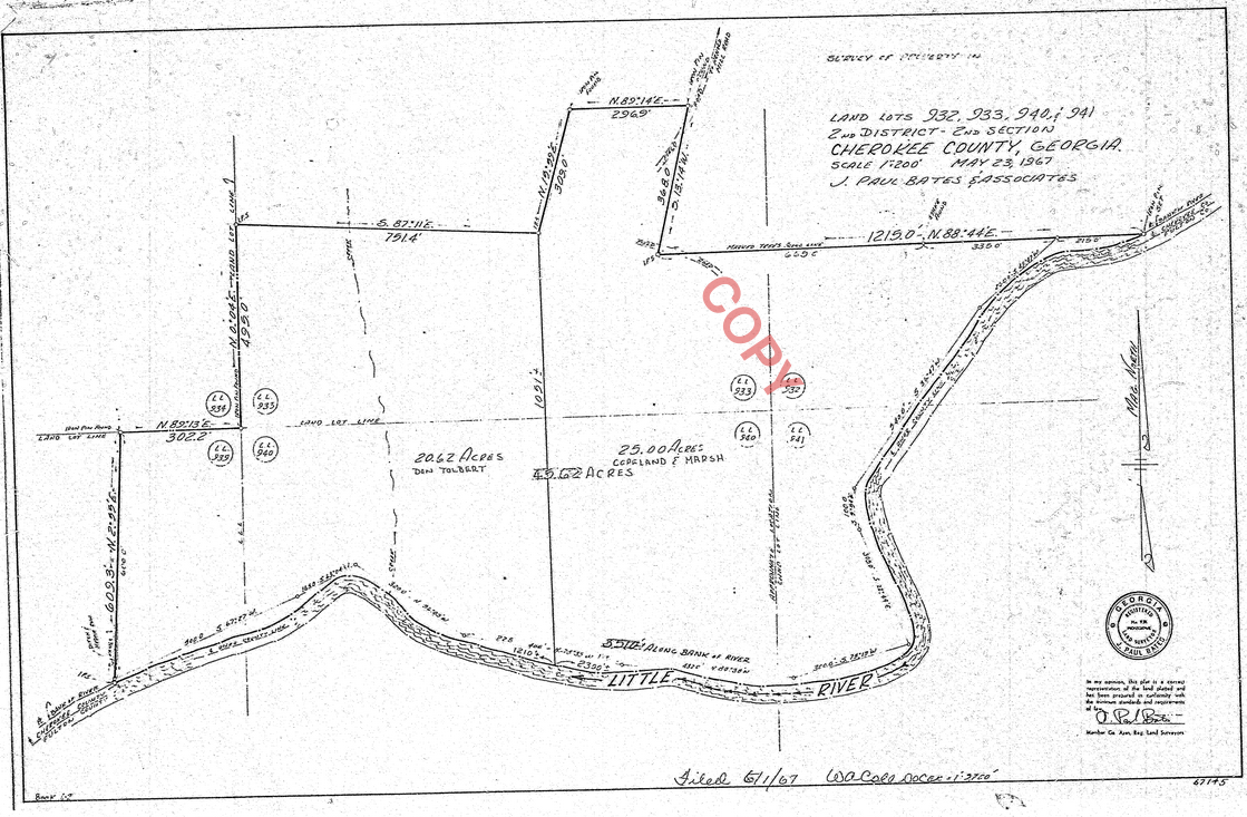
- [932, 933, 940, 941] – Plat recorded for a split in land between Don Tolbert (20.62 acres) and Copeland & Marsh (25 acres). Plat book 4/54. Research the deeds that split this land, and find out why its not listed as owned by Jeff Hedden in this plat based on Deed Book 50/59. Also, that top square section of land I believe was for the dam that was created to fill the resevoir.
- 1970
- [797, 860, 861, 869] – Warranty Deed from Jeff A. Hedden to Jeff A. Hedden Jr.(son) for 92 acres recorded in Book 111/137.
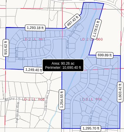
- [796] Warranty deed from J.D. Grimes to Freddie Turner and Jacquelyn Ann Turner for 4.3 acres of land recorded in Book 105/187. Approx diagram below.
- [797, 860, 861, 869] – Warranty Deed from Jeff A. Hedden to Jeff A. Hedden Jr.(son) for 92 acres recorded in Book 111/137.
- 1975
- [796] Affidavit signed by Grady L. Reece (70) stating that he is familiar for 60 years with the land that W.L./S.B. Grimes have owned. Described in Book 11/29.
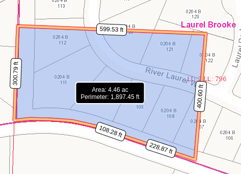
- [796] Warranty Deed from J.D. Grimes to Lloyd Brewer and Brenda Joyce Brewer for 4 acres of land as a “Love and Affection” gift. Deed book 190/675. Approx diagram below.
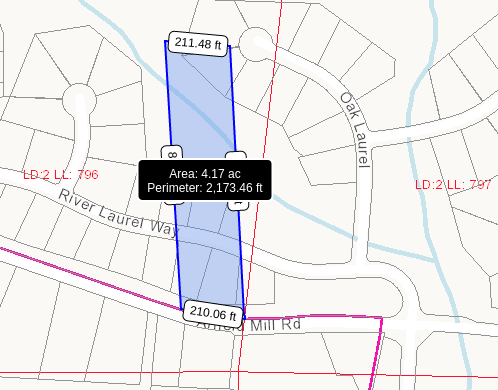
- 1978
- [796] – Affidavit signed by Flora Hardeman(78) stating she is familiar for 60 years with the land owned by Freddie Turner and Jacquelyn Ann Turner being 4.3 acres of land described in Book 105/187. Affidavit recorded in Book 234/36.
- 1992
- [796] – Warranty Deed for ¾ interest from Brenda Joyce Brewer(mom) via POA to Thomas D. Brewer(son)/Jacquelyn Ann Turner(daughter?) for 4 acres of land as a “Love and Affection – Gift to Kin” Deed Book 1157/32. See approx diagram above for 1975 Warranty Deed 190/675
- [796, 797] – Estate Deed from James D. Grimes for 1/3rd interest each: 1) Jacquelyn Ann Turner, 2) Thomas D. Brewer, 3) Ricky Hester and Tammy Burch for 51.8 acres of land. Deed book 1157/33. Approx diagram below.

- 1999
- [797, 860, 861, 869] – Warranty deed for 90.66 acres from Jeff A Hedden Jr. to Sharp Residential Builders & Developers LLC. Book 3771/106.
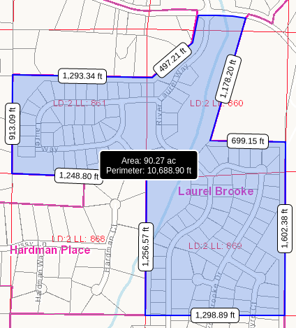
- [797, 860, 861, 869] – Warranty deed for 90.66 acres from Jeff A Hedden Jr. to Sharp Residential Builders & Developers LLC. Book 3771/106.
- 2003
- [796] [797] – 60.0215 acres of land owned by the following people was deeded over to Sharp Development for Unit 5 of Laurel Brooke:
- Thomas D. Brewer, Jacquelyn Ann Turner, Ricky Hester & Tammy Burch – Tract 1 (51.68 acres)
- Thomas D. Brewer and Jacquelyn Ann Turner – Tract 3 (4.0199 acres)
- Freddie Turner and Jacquelyn Ann Turner – Tract 2 (4.3216 acres)
- Need to research how land for the lower sections of Laurel Brooke in Land Lots 933, 932, 940, and 941 was acquired by Sharp Development.
- [796] [797] – 60.0215 acres of land owned by the following people was deeded over to Sharp Development for Unit 5 of Laurel Brooke: