If you have ever been traveling north on Hickory Flat Highway (GA-140) from Milton to Hickory Flat, you will have passed over Mill Creek near Buck Jones Nursery. Mill Creek is a tributary of the Little River and runs for approximately 10 miles.
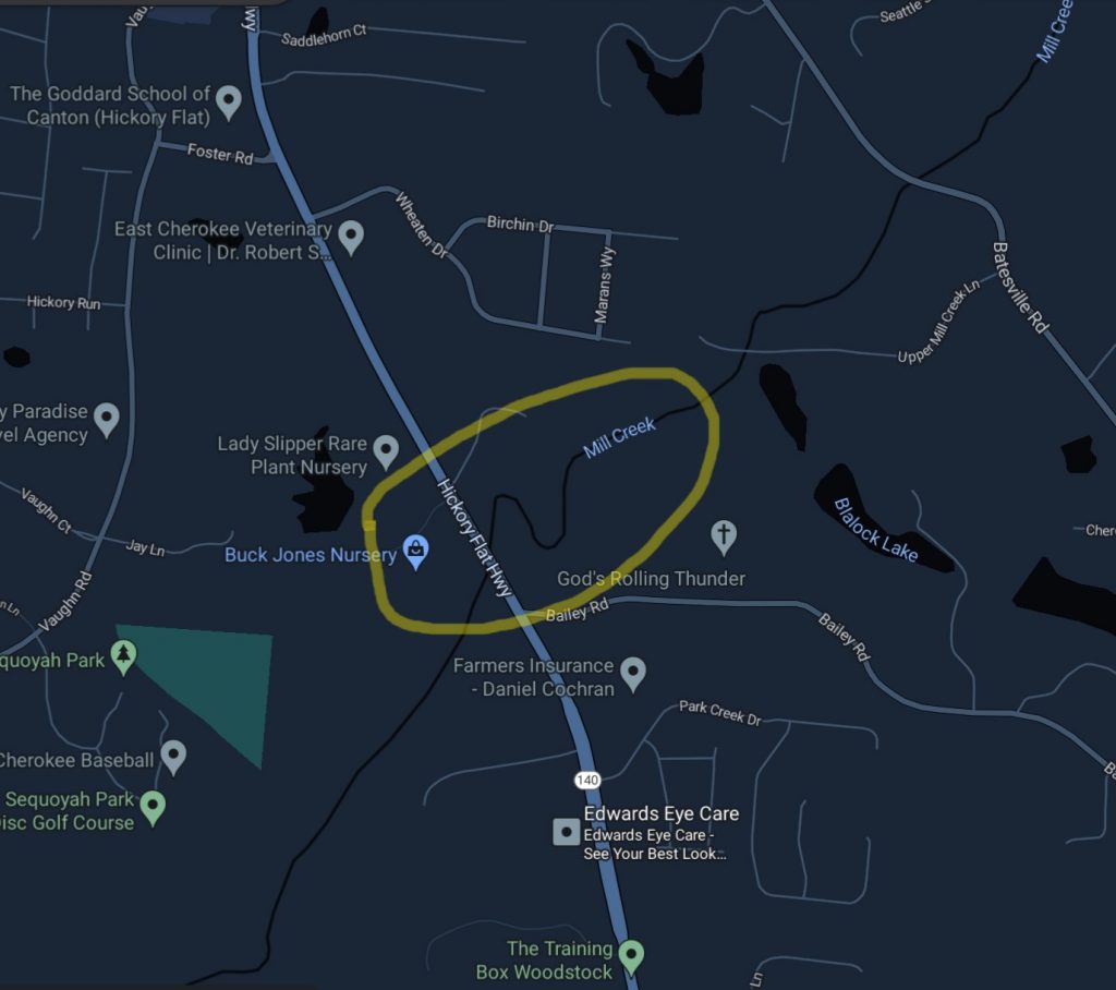
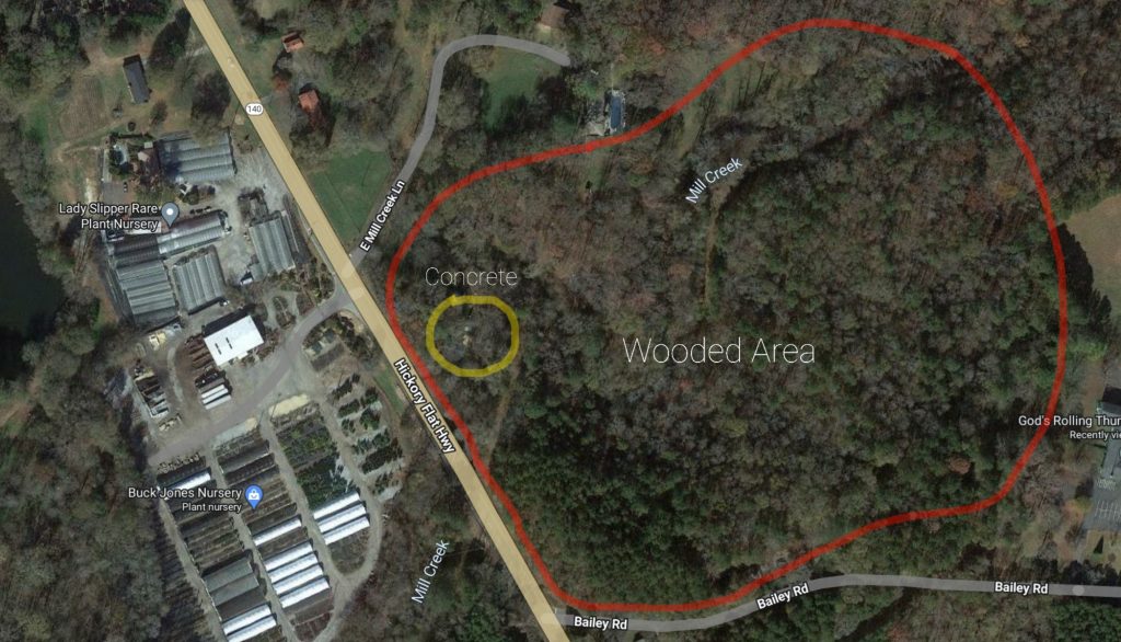
Now, this is something that most people probably won’t notice, but since I’ve been stuck in traffic so many times on my way to pick kids up from school I’ve had plenty of time to look around as I’m driving up GA140. When passing through this area shown in the circle above you cross over a bridge which covers the creek. It’s a modern bridge like any other one.
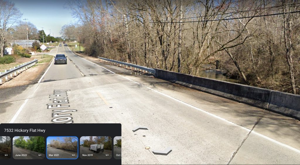
When the seasons change and leaves fall off the trees I began noticing something odd in the creek to the right of the bridge. Can you see it? Let’s zoom in a little.
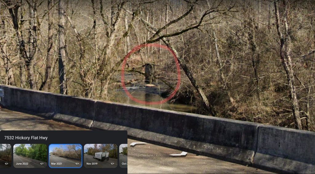
What is that? Some kind of post? Is it wood or concrete? Why is there so much water that looks like rapids in the surrounding area? This isn’t a huge creek and doesn’t flow all that fast, but something under the water is disrupting the smooth flow.
I pass by this enough that I began to wonder if this was a concrete footing for a bridge, and maybe the debris in the water was other fragments of the bridge or possibly another support that fell over. But… the odd thing is that all around this part of the river is absolutely nothing but wooded area. If there was a side-street that came off Hickory Flat Highway and crossed back over the creek, I don’t see it. No roads other than Bailey Road to the south of this, and it doesn’t go in the direction of the Creek.
So what is this thing?? Why would a bridge cross here? Maybe it was just a foot bridge. Again, there’s nothing here. It’s a wooded area. Putting a bridge here makes no sense for anything around it.
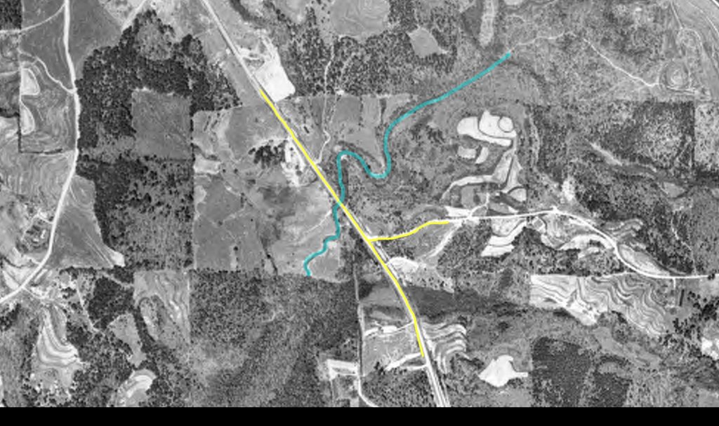
My next step is to go look at historic aerial photos of the area to see if some answers are in historical photography. I found an aerial photo from 1960 showing the area. Hickory Flat Highway looks normal, Bailey Road is there, and other than missing buildings like the plant nurseries, nothing odd in this image. I traced Hickory Flat Hwy, Bailey Road, and Mill Creek to show their positions.
Aerial photos older than the 1960’s are difficult to find for this area, but there is a nice set of images from 1938. These are very difficult to read because there’s not much in the area that is recognizable and most roads weren’t paved (or they just didn’t exist at all!). I did manage to find the area above in the images though, and it does reveal why there’s some concrete support structures in the middle of Mill Creek. I’ll post a closeup of the road side-by-side so you can compare the two.

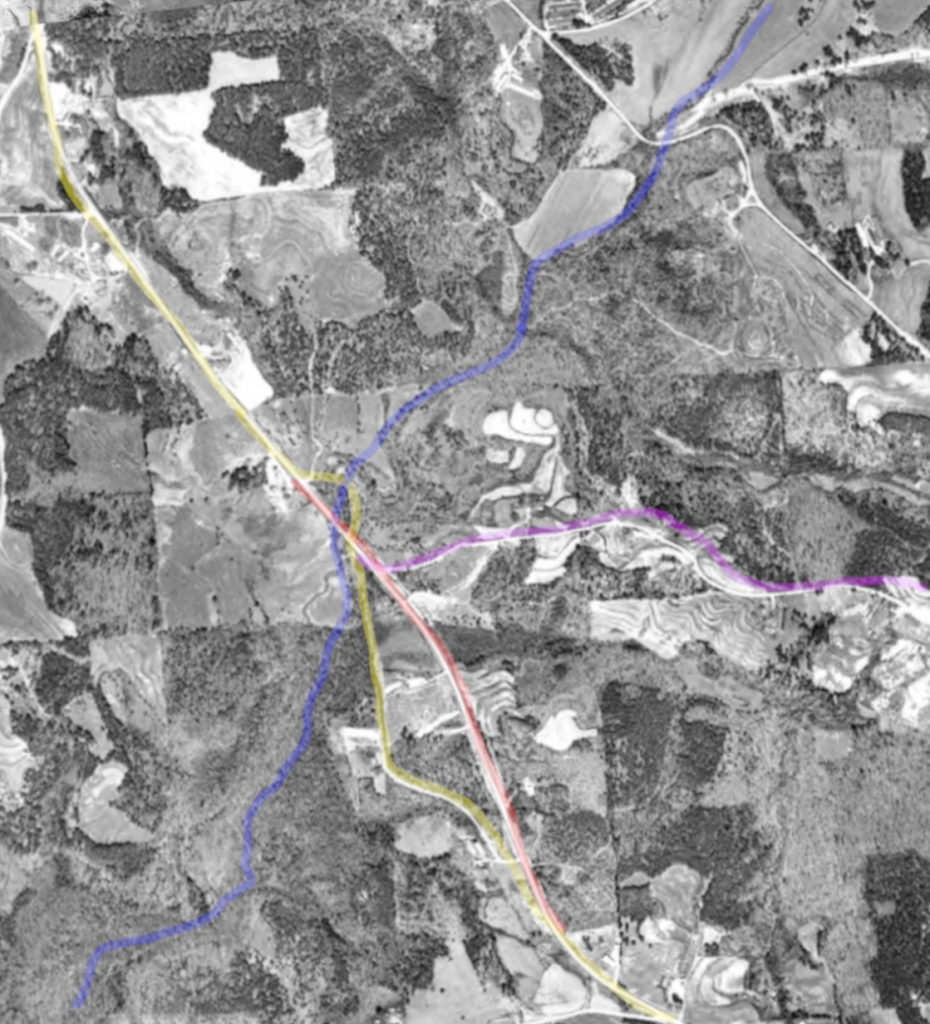
The left side of the yellow divider line is 1960 and the right side is 1938. If you have a keen eye you can see that Hickory Flat Hwy is shaped differently north of the intersection of Bailey Rd. It goes straight north, and then cuts to the west…. across an older bridge over Mill Creek! Then, it meets back up with the normal NW direction of the road we know today. Mill Creek also follows a different route after the bridge too. It was straight and doesn’t do the hair-pin shapes.
Here’s a highlighted image showing the routes…
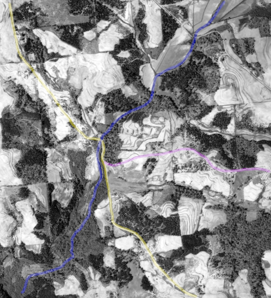
- YELLOW – Hickory Flat Highway (GA140) going NW
- PINK – Bailey Road
- BLUE – Mill Creek
So you can easily see that in 1938 Hickory Flat Highway crosses over Mill Creek on a different bridge which we see today as debris in the creek when you look to the east. So there you have it! Hickory Flat Highway did in fact get re-routed to a newer bridge some time between 1938 and 1960, and they just never cleaned up the old bridge entirely.
BONUS: I’ll cover this on another post later, but you may have noticed south of Bailey Road that Hickory Flat Highway also followed a different path and is not in the configuration we know it as today. It used to come off Jep Wheeler Road and then go more NW to meet up with Grace Community Church. Once passing the church, it continued directly north until it reached the old Mill Creek Bridge. Interesting, huh? Here’s the 1960 image with the 1938 annotations, and a new RED line showing Hickory Flat Highway as we know it today.
